The Menai Suspension Bridge
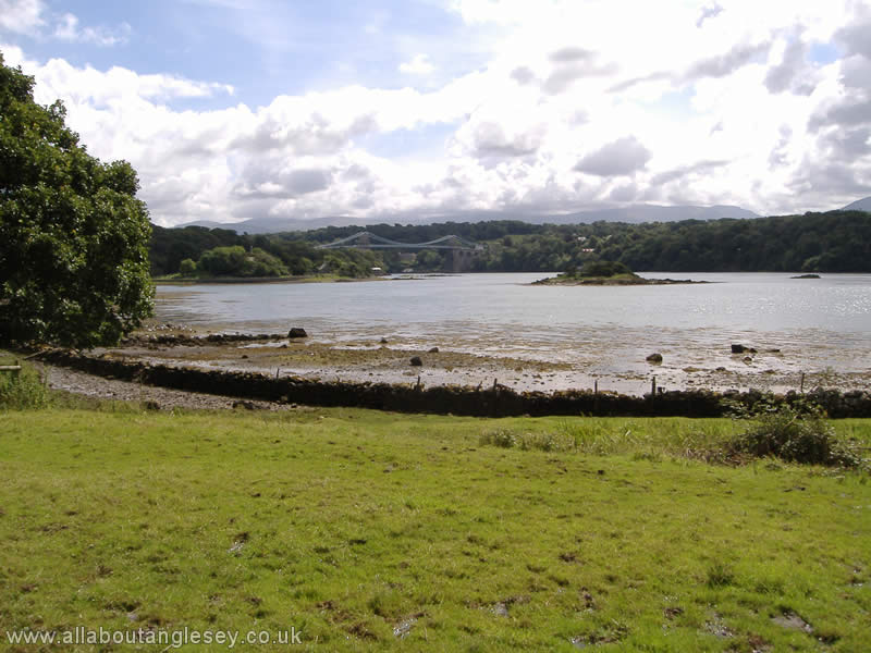
Anglesey is separated from the mainland of North Wales by the Menai Straits, a stretch of water known for its tidal range and fierce currents. Before the Straits were bridged in 1826, travellers were faced with crossing the Lavan Sands at low tide, or using a ferry, and a ferry crossing was often unpleasant or even impossible if weather conditions were poor. By 1800, with the passing of the Act of Union with Ireland, increasing numbers of passengers were using the important London-Dublin route, and the Government of the day decided a bridge was the logical way forward. The result is Thomas Telford's iconic bridge in a majestic setting.

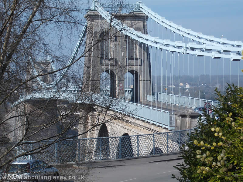
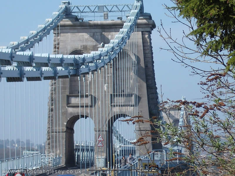
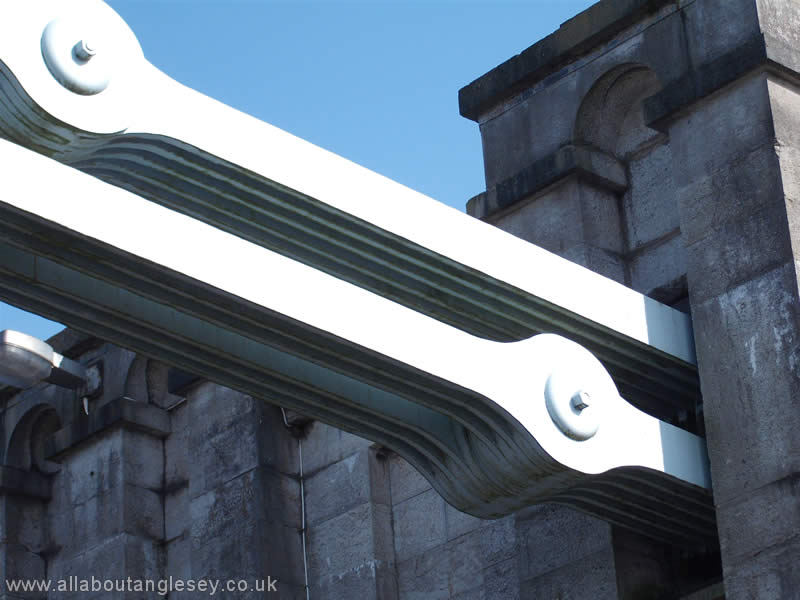
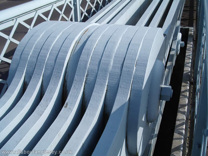
Apart from the difficulty of constructing what would be the largest bridge of its type in a difficult environment, the problems were increased by Admiralty demands that the bridge should be a minimum of 100 feet above mean sea level. At this time, Britain was a maritime nation, with a fleet of tall ships, and the Admiralty's stipulation was to ensure ships could pass beneath the bridge under full sail. When completed, the bridge was 1,007 feet (305 metres) in length, with a central span of 584 feet (177 metres). A toll was charged until 1940.
The Bridges or Y Pontydd
Anglesey is famous for the two bridges which cross the Menai Straits, and join it to the mainland.
Thomas Telford's Menai Suspension Bridge was opened in 1826, and notwithstanding some works over the years, looks very much as it would have done to the stage coach passengers travelling to and from Ireland at that time.
The same cannot now be said for Robert Stephenson's Britannia Bridge. This provided a rail crossing of the Menai Straits, and was opened in 1850. Some 120 years later, the bridge was all but destroyed by fire, and the need to rebuild resulted in the addition of supporting steel arches and a road deck over the rail level. What the visitor sees now is very different from the original construction, although the towers and the lions which stand guard are much as they would have been back in 1850.
For more on either or both of these bridges, use the Main Menu links on the left.
Menai Bridge or Porthaethwy

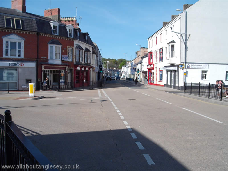
Porthaethwy , or the Port of Aethwy, is the Welsh name for Menai Bridge, Aethwy being an ancient Celtic tribe. This illustrates a common feature of place names, in that the English name is not a direct translation from the original Welsh. Of course, the English name would only have come into existence following the construction of the suspension bridge across the Straits in 1826. Prior to its construction, ferries carried people and goods across the Straits.
Menai Bridge is noted for its waterfront, with a promenade leading to St George's Pier. In Victorian times, pleasure boats regularly embarked from St George's Pier to Llandudno, a practice which still takes place today, albeit with less frequency. A modern walkway from the promenade leads to the berth for Prince Madog, a maritime research vessel belonging to the University of Wales, Bangor.
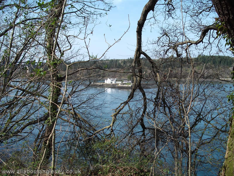
From the base of the Menai Bridge, one may walk in the direction of the Britannia Bridge along the Belgian Promenade. This was built by Belgian refugees during the Great War (1914-1918). The promenade skirts a hilly wooded area known as Coed Cyrnol, or the Colonel's Wood. There are a number of paths through the wood. However, if you continue along the promenade, it leads to a causeway connecting to Church Island or Ynys Tysilio. The path then goes around the outside of the island, at one point giving superb views towards the Britannia Bridge. The building in the middle of the Straits is Ynys Gorad Goch, or the island of the red weir. This is a private house, with two fish weirs, to catch fish at both states of tide in the Straits. Back on Church Island, a branch off the main path takes you to the church of St Tysilio, which dates back to the fourteenth century. Further information on Eglwys St Tysilio can be found on our Anglesey Chapels and Churches page.
Further details can also be found on our Menai Suspension Bridge page.
Llangefni

Llangefni is located just off the A55 Expressway in the centre of the island. It is the county town and administrative centre of Anglesey, and the County Council has its main office and council chamber there. It is an historic market town, with a stone clock tower in its central square, a feature shared by a number of other towns and villages on the island, such as Rhosneigr and Newborough.
 Llangefni is home to Oriel Ynys Môn, the museum and arts centre, which was opened by Queen Elizabeth in October 1991. The Oriel's main gallery hosts a number of major exhibitions every year, many with a local focus.
One of the biggest attractions is the Sir Kyffin Williams Gallery, which opened in 2008. The County Council has over 400 of Sir Kyffin's works of art, and a number of these are always on display, together with other original works from other collections.
The Oriel is also home to a substantial collection of drawings and paintings by the famous wildlife artist Charles Tunnicliffe.
Key features of the town are the Town Hall or Neuadd y Dre, which was constructed in 1884 with limestone quarried on the eastern coast of Anglesey. It overlooks the central square or Maes Bulkley, with its stone tower and clock, also built from limestone.
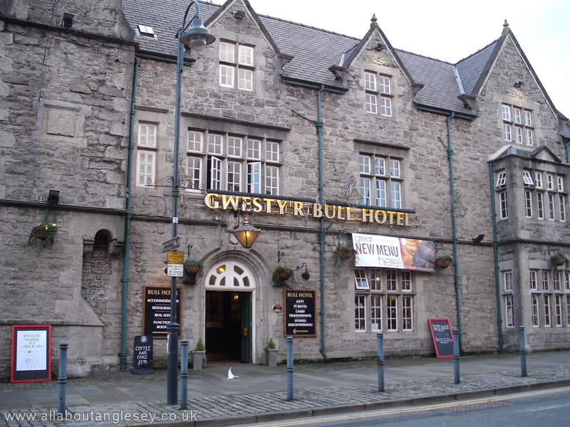 At one side of the square is the impressive Bull Hotel or Gwesty'r Bull. A street market takes over the square and the adjoining car parks two days a week, Thursday and Saturday. Llangefni also has its own leisure centre at Plas Arthur.
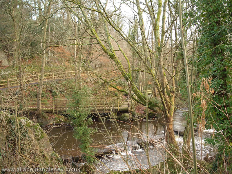
On the outskirts of Llangefni is Nant y Pandy, or the Dingle. This is an extensive nature reserve comprising woodland and wetlands, with easy access over footpaths and boardwalks. One walk leads to Llyn Cefni, one of two reservoirs which supply drinking water to the people of Anglesey. This reservoir was created after the Second World War by damming the Afon Cefni. For the keen walker, it is possible to walk most of the way round the lake.
Instead of going around the reservoir, the railway took a more direct route of crossing it on an embankment and bridge.