
Holyhead or Caergybi

Holyhead, the largest town on the island, is known as Caergybi in Welsh, which means the fort of Cybi, a Welsh saint. It had previously been known as Llan y Gwyddel, Eglwys y Bedd, and Cor Cuybi. In 1315, it was known as Haliheved, in 1536-39 The Holy Hedde, and in 1573, Holy Head or Caer Cybi. To the Romans, it was Sacrum Promentarium, which translates exactly as Holyhead. It is believed the name originally referred to the mountain which dominates this part of Anglesey. Note that Holyhead is always pronounced Hollyhead.
George Borrow, in his famous book 'Wild Wales, Its People, Language and Scenery' wrote about his visit to Holyhead in 1854 in these words.
"Caer Gybi, or Cybi's town is situated on the southern side of a bay on the north-western side of Anglesey. Close to it on the south-west is a very high headland called in Welsh Pen Caer Gybi or the head of Gybi's city, and in English Holy Head.... It is called Cybi's town from one Cybi, who about the year 500 built a college here to which youths noble and ignoble resorted from near and far."
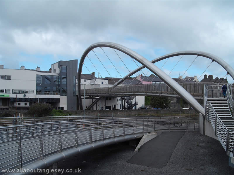 Holyhead owes much of its existence to the fact that, at the start of the 19th century, it was chosen for the strategically important port linking London and Dublin (Ireland). It marks the end of the historic A5 trunk road from London, which was designed by the famous engineer, Thomas Telford. It is best known as a point of arrival or departure from and to the republic of Ireland, being synonymous with ferry travel, and it is now the third busiest port in the United Kingdom after Dover and Felixstowe. Its position as the principal port of North Wales was initially in doubt when a route to Ireland was first proposed, as the first choice was the now quiet Morfa Nevyn on the Lleyn Peninsula. It was thought this was a better route as it did not require a crossing of the Menai Straits, which at this time had yet to be bridged. However, Thomas Telford's Menai suspension bridge, erected in 1826, meant that the Straits were no longer an obstacle to commercial travel. From then on, Holyhead's pre-eminence was assured, and it has remained unchallenged for nearly 200 years.
Holyhead's roots go back much further, and there is evidence of neolithic occupation in the area around South Stack. Further information on the Ty Mawr Hut Circles can be found on our Anglesey Archaeology pages. More recent was the occupation by the Romans, who constructed a hill fort on Holyhead Mountain. This fort was ancillary to the larger fort of Segontium (Caernarfon).
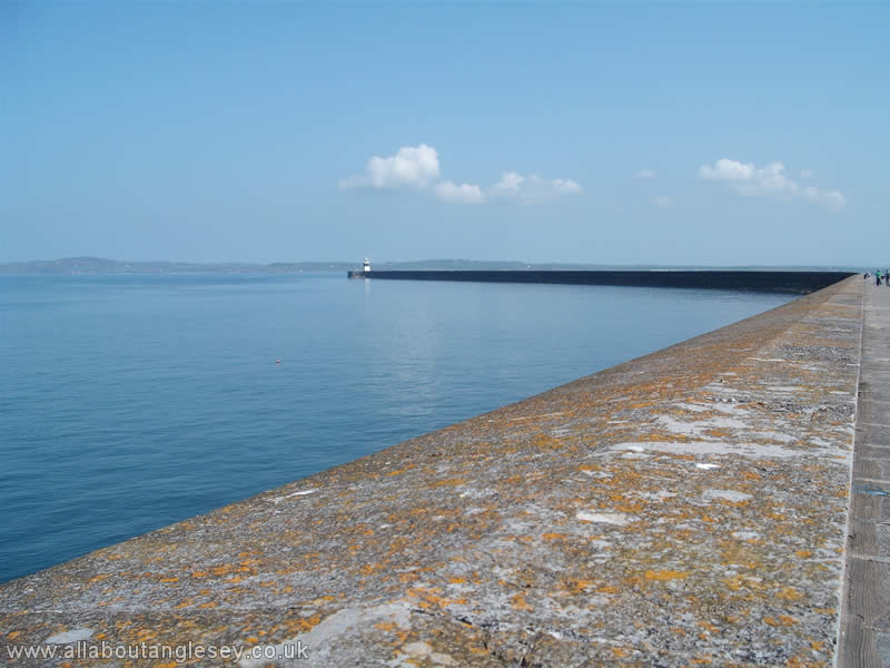 The seaward side of the town is dominated by the breakwater. This took 28 years to build, and was completed in 1873. It is possible to walk its entire 1.5 mile length, although this is not recommended in high winds as waves can top the breakwater. The breakwater shields an area in excess of 660 acres, providing abundant safe mooring for both pleasure and commercial craft. It has a marina at its western end, and there are plans to create a new marina further along Newry Beach.
The breakwater was constructed from stones quarried from Holyhead Mountain, and transported to the site by rail. The quarry area has in more recent times been transformed into the Breakwater Country Park, a peaceful haven with a small pool, with wheelchair access around it. The pool is popular with model boat enthusiasts on Wednesdays and Sundays, and with anglers, although fishing permits are required.
Ucheldre Centre, Holyhead
On the landward side, Holyhead's community and arts centre, Canolfan Ucheldre, features prominently. The meaning of Ucheldre is high town, and the name reflects the fact that the building is in the upper part of Holyhead. The Canolfan Ucheldre is all that is left of the French Roman Catholic convent for the order of the sisters of Bon Sauveur, and is in what was the former convent chapel.
The centre includes exhibition halls, an amphitheatre, a shop and a restaurant. The most striking feature of the main hall is the air of serenity that seems to speak of a much older building, when in fact the hall dates from the 1930s.
The restaurant is also of architectural interest with its use of massive Scandinavian curved pine beams. A doorway from the restaurant leads to a secluded garden, where some features from the original convent have been imaginatively incorporated into the overall scheme. A fountain sculpture "The Beginning of Life" is a particular feature.
In the grounds, there is another work of art, a sculpture of a pole vaulter, representing a leap into the future perhaps, or Welsh aspirations. Details of the many and varied events staged at the Ucheldre are on the centre's website, www.ucheldre.org/.
Beaumaris or Biwmares

The town of Beaumaris, on the south-eastern corner of the island, derives its name not from the Welsh, but from French via the Normans. It was known as Beau Marias, or good marsh, which was a good description of the site chosen by Edward 1 for the construction of his castle, the last of his series of castles in Wales. The location was chosen with care to guard the eastern approach into the Menai Straits. The castle was built between 1295 and 1297, but never entirely finished. Unlike other North Walian towns such as Conwy, Caernarfon and Harlech, which are dominated by their castles, Beaumaris castle is an understated low built structure. For those with knowledge of the other castles built at Caernarfon, Conwy and Harlech, Beaumaris appears on a much smaller scale, but it is listed by UNESCO as a World Heritage Site. Further information on the castle can be found on our Anglesey Archaeology pages.
Beaumaris was once the county town and chief port of Anglesey, roles now assumed by Llangefni and Holyhead respectively.
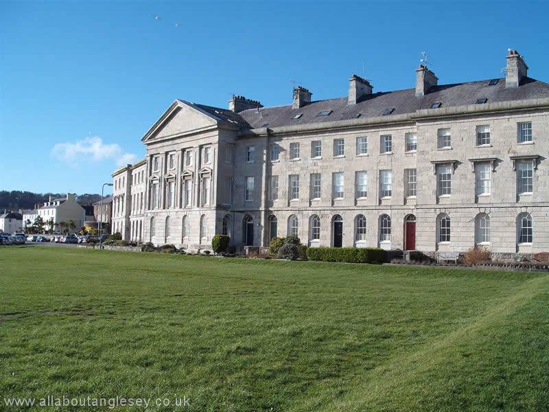
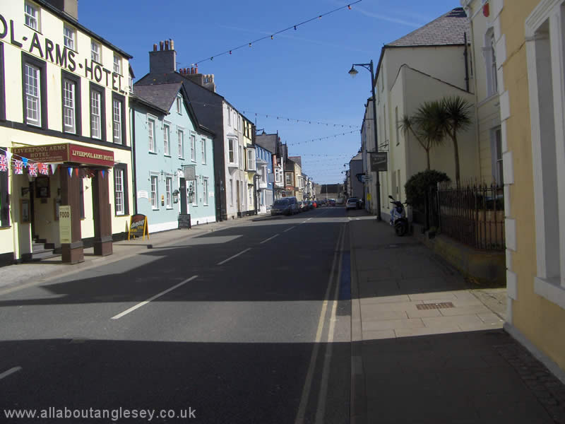
The seaward side of the town is dominated by the Bulkeley Hotel and Victoria Terrace, with magnificent views over the Menai Straits to the mountains of Snowdonia. The main street on the landward side is Castle Street, with the castle itself at its eastern end. Other notable buildings on Castle Street are the Old Bulls Head, built in about 1475, Tudor Rose which dates from about 1400, and the Town Hall or Neuadd y Dref which dates back to 1563.
Close to the castle is the White Lion public house, in front of which is a small square. Over summer weekends, this is often the site of street entertainment, ranging from folk music and dancing to performances by the Beaumaris Band. Close by is Canolfan Beaumaris, a small public hall with sports facilities and a small exhibition area.
On the seafront, the promenade provides stunning views over the Menai Straits, to Llanfairfechan and down as far as the Great Orme and Llandudno. There is a busy lifeboat station, and the pier is popular with tourists, whether crab fishing or angling, enjoying the scenery, or as a departure point for cruises around the nearby Puffin Island. The pier is a modest structure, some 570 feet (174 metres) in length, but its claim to fame is that it is the only pier on Anglesey.
St Mary and St Nicholas Church, Beaumaris
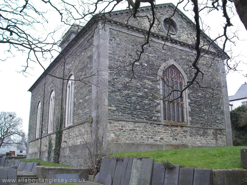
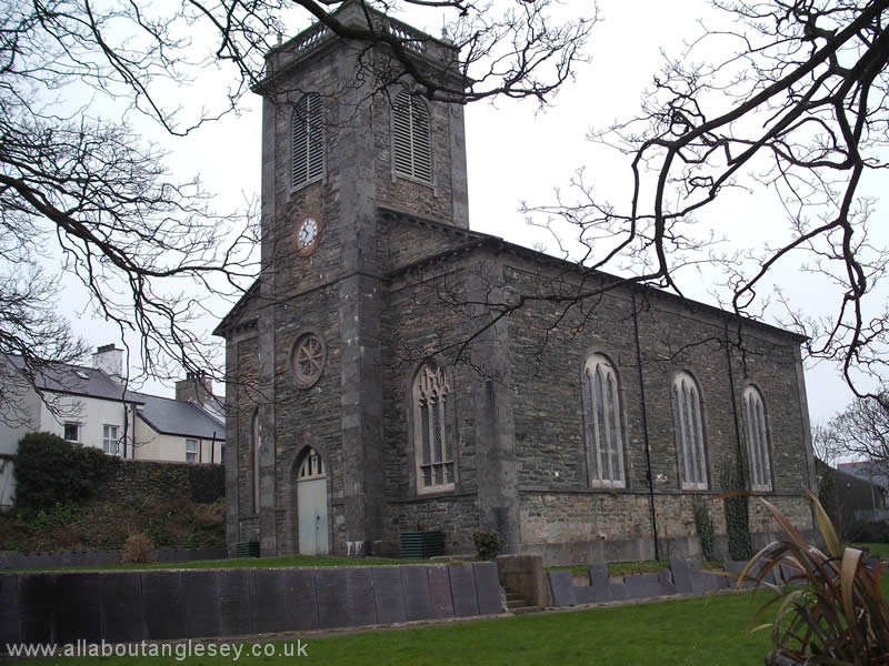
 The Grade 1 listed church of St Mary and St Nicholas is tucked away from the main street, in Church Street. It was mainly built in the fourteenth century, not long after the castle was built, although the chancel dates from the fifteenth century. In the south porch is a sarcophagus or stone coffin of Princess Joan, daughter of King John, who died in 1237. Further information on St Mary and St Nicholas Church can be found on our Anglesey Chapels and Churches page.
Other points of interest in Beaumaris include the Courthouse and Gaol.
Amlwch

The name Amlwch derives from two welsh words, am and llwch, meaning around or near the creek or inlet, a reference to the harbour at Porth Amlwch, which is a short walk from the town of Amlwch itself.
This town is in the north east of the island, and is the most northerly town in Wales.
It may be difficult to appreciate now, but Amlwch was once the world's leading exporter of copper. That was back in the early nineteenth century when copper, extracted from the nearby Parys Mountain, was taken to the harbour at Porth Amlwch, and loaded on to boats for export. The incoming cargo was often tobacco leaf, which was processed in one of a number of tobacco factories in Amlwch.
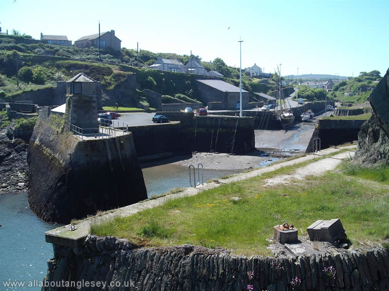
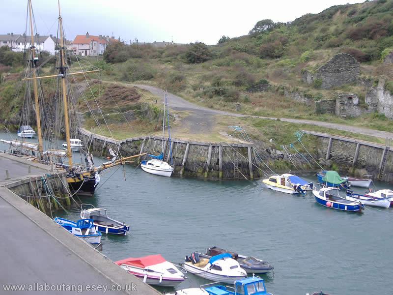
Another key industry was ship building, originally in timber but latterly in iron. Looking at the modest scale of the harbour, it is difficult now to imagine Amlwch was once a thriving industrial area, with ship-building yards, and a tobacco industry. Its maritime role continues to this day, and it is not unknown to see Mersey Docks and Harbour Board pilot boats moored in the outer harbour.
Amlwch was once the northern terminus of the Anglesey Central Railway, which linked to the main Holyhead to London line at Gaerwen. It closed to passenger traffic in 1964 when it fell victim to Dr Beeching's cuts, although it continued to be used for some freight traffic. The line finally closed in 1993. There are tentative plans for the restoration of at least part of Anglesey Central Railway.
You may explore Amlwch's history at the Heritage Centre and Cafe, housed in the Sail Loft. The Centre is generally open from Easter through summer.
Amlwch Chapels and Churches
In the centre of the town is St Eleth's Church, which was built in 1880 in the Neo-classical style with funds from the Parys Mountain Company. It is a Grade 2* listed building, which means it is a building of special architectural or historical interest. The clock strikes by day but is silent by night, and is wound once a week by the local butcher.
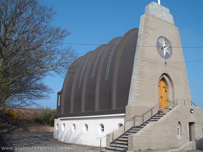
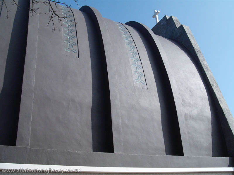
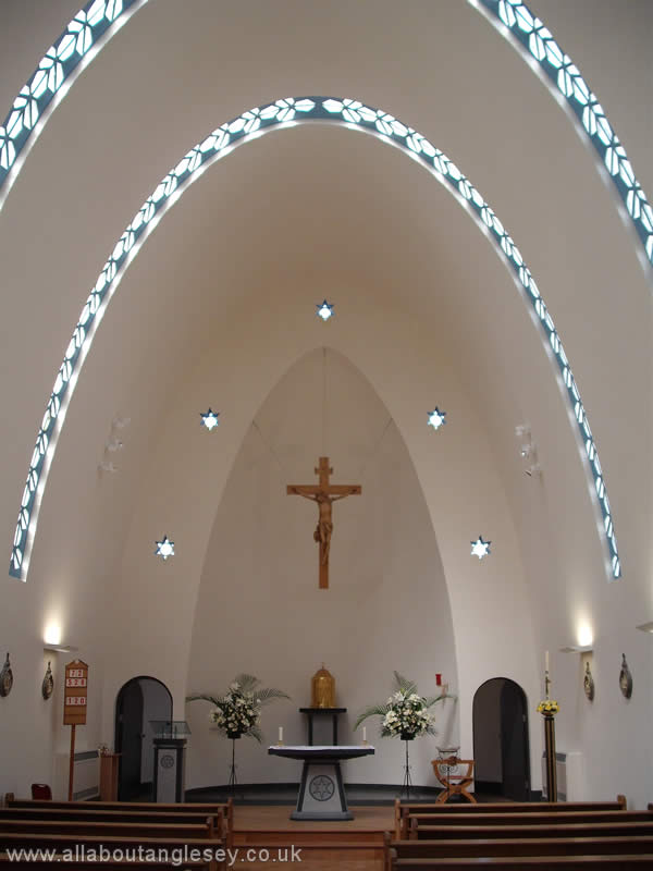
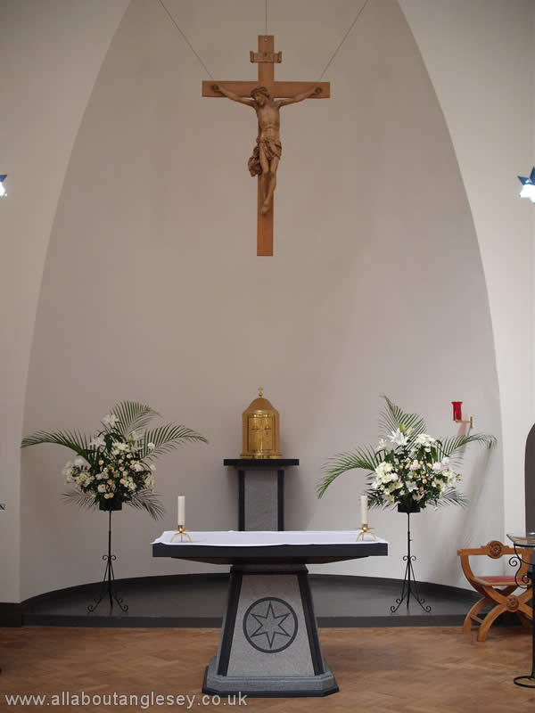
On the road to Bull Bay lies the church of Our Lady, Star of the Sea, and St. Winefride. This modernistic Roman Catholic church was designed by an Italian architect living in Conway. Completed in 1937, and extensively refurbished in 2011, the unusual design represents an upturned boat, with the round windows at ground level symbolising portholes. The church is orientated on a north-south line, which means sunlight filters through the uncoloured glass windows throughout the day. The altar was commissioned as part of the 2011 refurbishment, and is made from local Welsh slate and granite.
Five Towns or Pum Tref
There are five towns on Anglesey. In alphabetical order they are:
- Amlwch, on the north coast,
- Beaumaris, in the south east,
- Holyhead, in the north-west,
- Llangefni, in the central area of the island, and
- Menai Bridge, on the south coast.
To explore further, select one of the links above, or from the Main Menu to the left.