
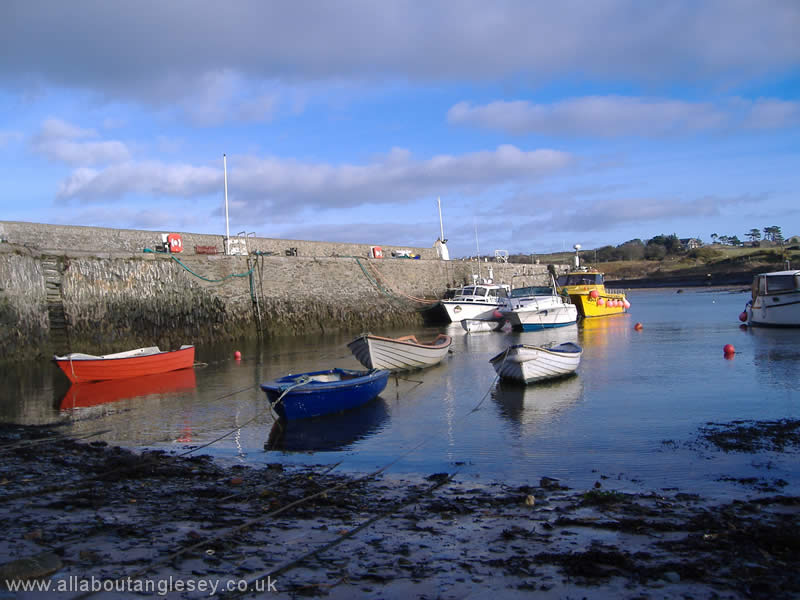
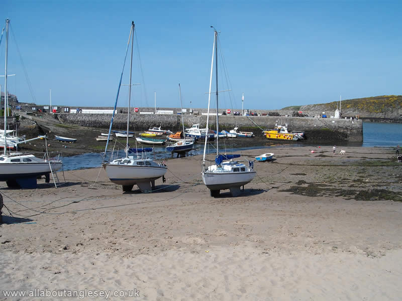
Cemaes
Cemaes is the most northerly village in Wales, with a picturesque harbour, sandy beaches and safe bathing. It is yet another popular resort for holiday-makers. A stone built breakwater shelters the harbour where pleasure and working craft are moored. Cemaes once had its own shipbuilding industry, but Amlwch proved a more successful centre, particularly with its larger population and work force.
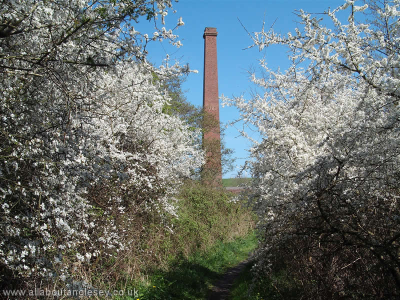
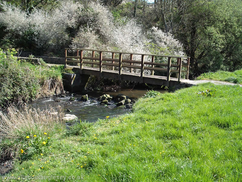
The A5025 road skirts around Cemaes, separating the village from the former brickworks. Although production of bricks ceased as long ago as 1914, the factory chimney and kiln remain in situ, albeit in a deteriorating condition. When the brickworks was functioning, the bricks were taken from the works on a tramway to the harbour. The route now forms an attractive walk along the valley of the river Wygyr.
On the eastern headland lies the historic church of Llanbadrig. Further information on Llanbadrig Church can be found on our Anglesey Chapels and Churches page. The headland is also home to the only vineyard in Wales.
In contrast, the western headland is dominated by Wylfa Nuclear Power Station, but it should be noted that there are excellent walks around Wylfa Head.
Carmel Head
This is at the north-western tip of the island, from which there are spectacular views over the Irish Sea and towards the Skerries with its red and white lighthouse. The coastal path to Carmel Head, whether from Ynys-y-Fydlyn to the south or from Cemlyn to the east offers some of Anglesey's finest scenery.
Copper workings took place in this remote spot, and some evidence of it remains to this day, with ruined buildings, and a factory chimney. The two tall triangular structures are known locally as the White Ladies, and were navigation aids. They line up with the rocky island of West Mouse or Maen y Bugail, on which may be seen another white beacon.
Much of this area is owned by the National Trust, and there are some seasonal restrictions on access to some areas during the shooting season. Pheasants are reared for sport in the woods nearby.
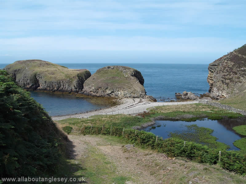
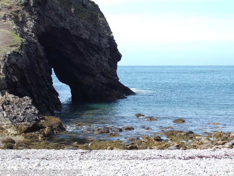
The island immediately off-shore is Ynys-y-Fydlyn, the northern side of which contains a sea arch.
Cable Bay, or Porth Trecastell

There are 2 Cable Bays on Anglesey. This one lies just north of Aberffraw on the west coast, whilst the other, Porth Crugmor, is just south of Church Bay. The Porth Trecastell Cable Bay gets its name from 1902 when a telegraph cable linked it to Ireland and from there to America. The connection has long since been abandoned. On the northern headland of Cable Bay stands the Neolithic burial chamber, Barclodiad y Gawres, or the apron of the giantess - believed to be a fanciful reference to how the mound was formed. Further information on Barclodiad y Gawres can be found on our Anglesey Archaeology pages.
Bull Bay, or Porth Llechog
Bull Bay lies just west of Amlwch, and has one of the island's most scenic golf courses. Bull Bay is now a small bay where tourism is the main industry. In earlier times however, it had a shipyard, lifeboat station, and a pilot station. There are expansive views over the Irish sea, and to the island of East Mouse or Ynys Amlwch. There are a number of interesting walks focused on Bull Bay.