
Places A - G
Once you have explored the five towns, then there are a large number of interesting places to visit. They are split into three groups, A-G, H-O, and P-Z.
In A-G, you will find:
Anglesey Lighthouses
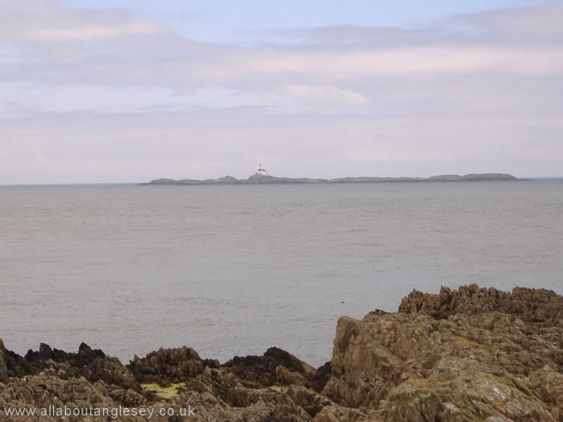
There are 5 lighthouses operational around the coast of Anglesey. They are at Trwyn Du in the south east, Point Lynas in the north east, The Skerries, off the north west coast, South Stack, north west, and Holyhead, also north west. In addition, redundant lighthouses are evident around the coast, including two at Llanddwyn Island, Ynys Llanddwyn.
Trwyn Du, Penmon
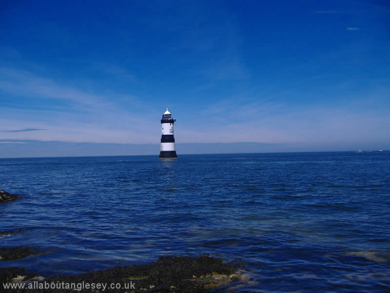
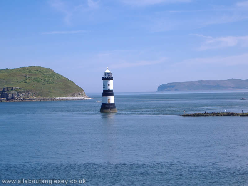
Trwyn Du, or Black Point, dates from 1838, and guides sailors through the passage between Penmon and Puffin Island. The mournful sound of its fog bell is heard every 30 seconds, regardless of the weather conditions.
Point Lynas
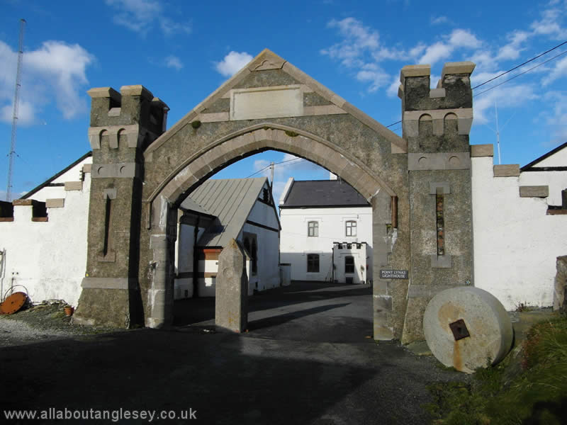
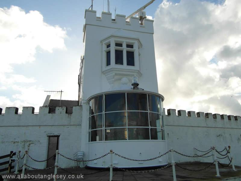
Point Lynas lighthouse is located on the north-eastern tip of Anglesey. It was built to safeguard the passage of ships to and from Liverpool. There is also a pilot station nearby, from which pilots go out to larger vessels to ensure safe navigation through to Liverpool.
The Skerries
The Skerries was erected on a platform of semi-submerged rocks off the north-western coast of Anglesey. Its name is thought to derive from the Vikings, the name meaning 'rocks'. In Welsh, it is known as Ynysoedd y Moelrhoniad, or 'seal islands'. The lighthouse was originally in private ownership, but was acquired by Trinity House in 1841, with compensation in excess of £400,000 being paid to the owners. The Skerries was automated in 1987. The area around the Skerries is currently being considered for tidal energy production. Thanks to Trinity House for the photograph.
Twr Bach and Twr Mawr, Llanddwyn
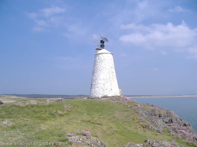
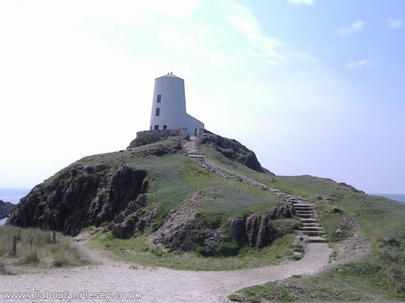
There are two redundant lighthouses at Llanddwyn, the little tower, or Twr Bach built in 1800, and the large tower or Twr Mawr, built in 1845.
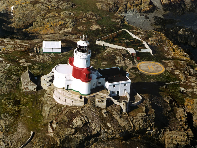
South Stack, or Ynys Lawd
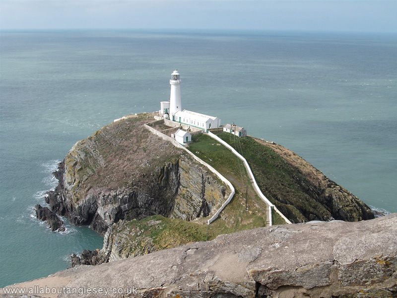
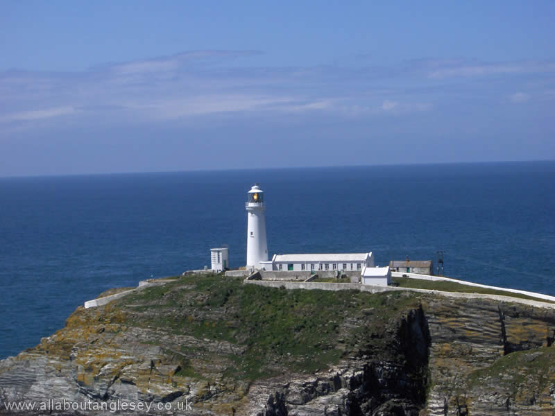
This is one of the most iconic lighthouses, with a dramatic setting at the foot of precipitous cliffs. The first lighthouse on the stack was built in 1809, and was automated in 1984. The surrounding cliffs are noted for the variety of bird life, and the Royal Society for the Protection of Birds has an information centre at the nearby Ellin's Tower.
Holyhead Breakwater
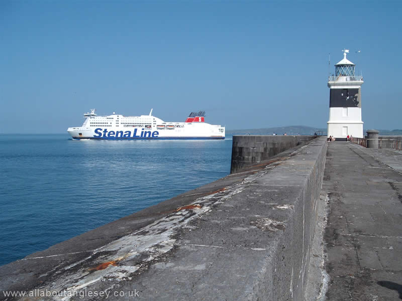
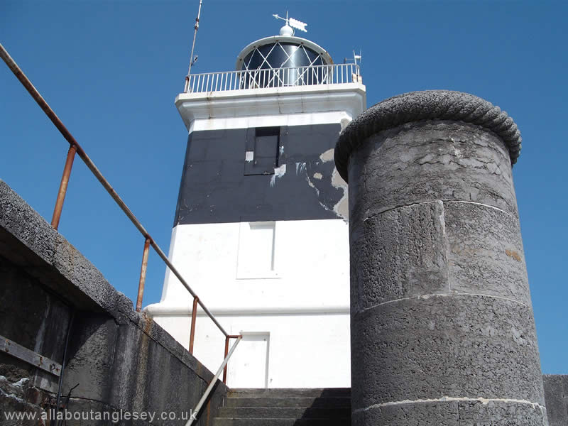
The lighthouse at the end of the breakwater is unusual in that it is of square section, rather than the conventional circular one. It was last manned in 1962.
Anglesey Archaeology
Information and images of Anglesey's archaeology may also be found in the Five Towns and Places menus under the Main Menu.
Aberlleiniog Castle

One of the lesser known historic sites on Anglesey, Aberlleiniog Castle lies to the east of Llangoed, on the south-eastern corner of the island. The castle dates from about 1090, and was constructed by the Normans. It predates Beaumaris Castle by some 200 years. Originally constructed of wood on a raised mound, it was later reconstructed of stone.
Barclodiad y Gawres, Cable Bay
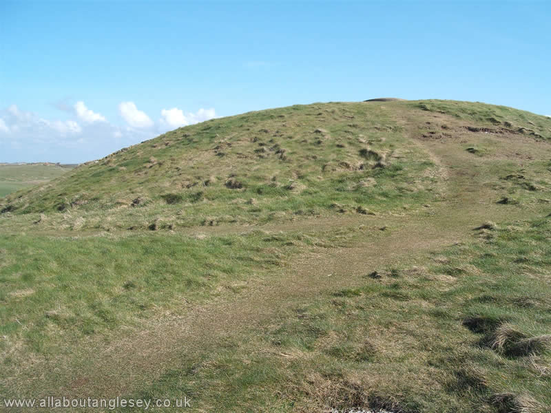
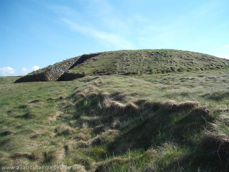
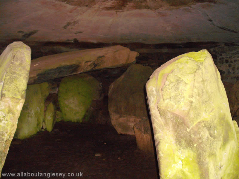
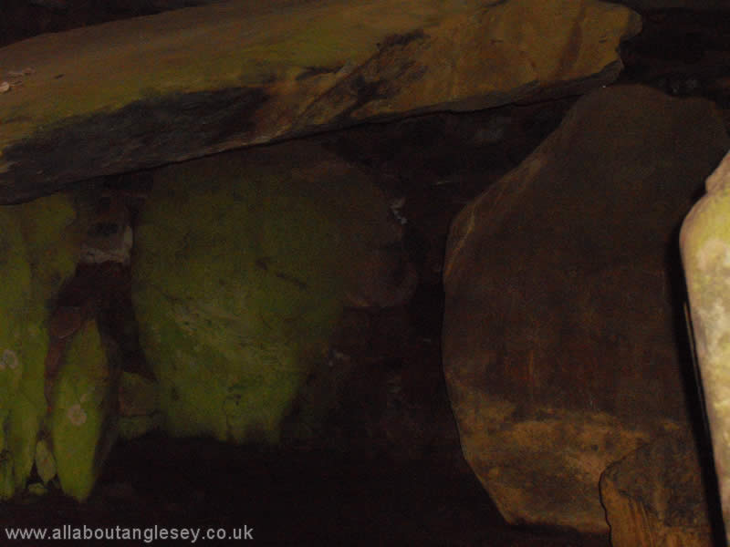
This burial chamber is in a most impressive setting on the northern headland of Cable Bay, or Porth Trecastell. This site is recognised as one of the most important in the United Kingdom, dating as it does back some 5,000 years. The name Barclodiad y Gawres means the apron of the giantess, which is a fanciful implication of how the mound was carried to the headland. Public access is restricted and if you wish to enter the chamber, you will need to be accompanied. Details of arrangements for access are at the site. A torch is strongly recommended to be able to see the individual burial chambers, and carved stones.
Beaumaris Castle


The last castle to be built in Wales on the orders of Edward 1, Beaumaris is perfectly sited to defend the eastern approaches of the Menai Straits. It was constructed by Master James of St John, who had been responsible for the rather more imposing castles at Caernafon and Conwy, amongst others. In addition to very substantial outer and inner walls, the castle had a moat from which access could be gained to the sea. The castle was constructed between 1295 and 1297, but never entirely finished. The materials for its construction came from the nearby Penmon Quarry.
Beaumaris Castle is recognised by UNESCO as a World Heritage Site.
Bryn Celli Ddu
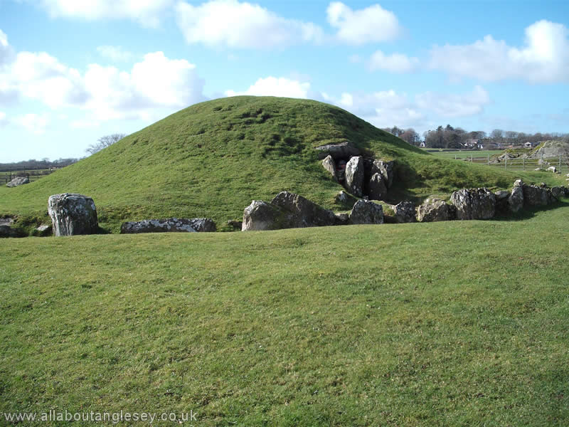
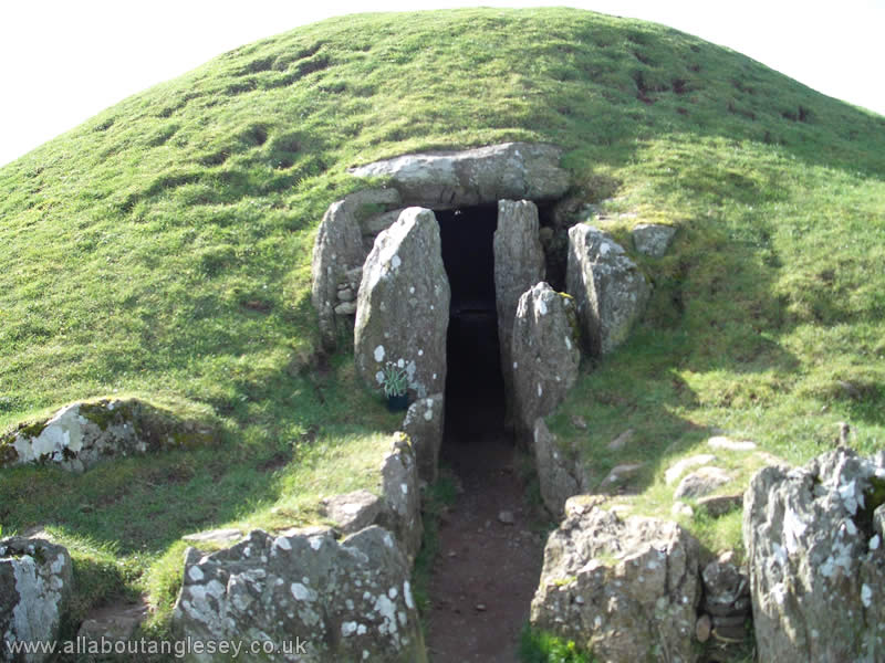
This is a well preserved Stone Age burial mound to the south east of Llanddaniel, dating back over 4,000 years. Bryn Celli Ddu means the Mound in the Dark Grove. The earliest monument here was a henge, or circular bank and ditch, surrounded by a stone circle. This then became a passage grave and cairn. The passage is aligned so that the rising sun shines through it on mid-summer's day. The greensward covering on the mound is a later reconstruction, and the original mound covered a greater area.
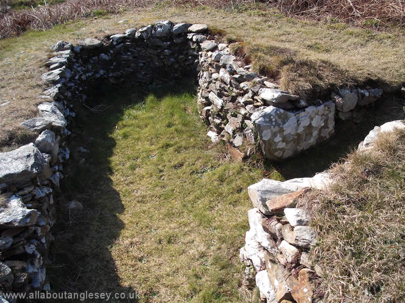
Din Lligwy
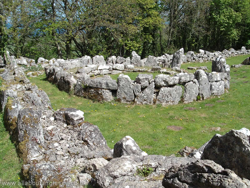
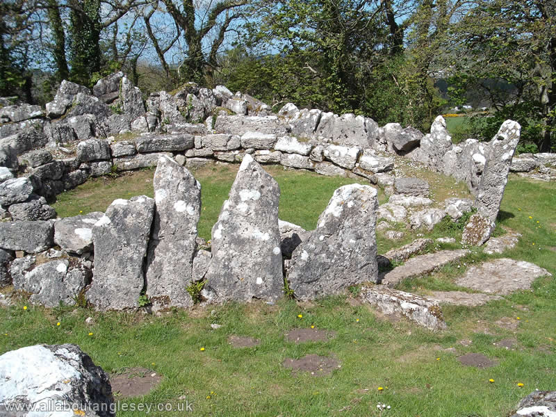
A mystical place dating from the first century AD. The outer walls are well-preserved, and surround the remains of rectangular and circular structures. Although built on raised ground, the settlement is well hidden from sight by the surrounding trees.
For details of Hen Gapel Lligwy, dating from the twelfth century, see below.
Din Lligwy Burial Chamber
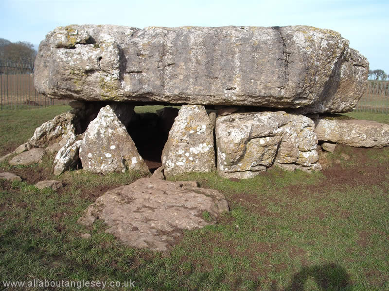
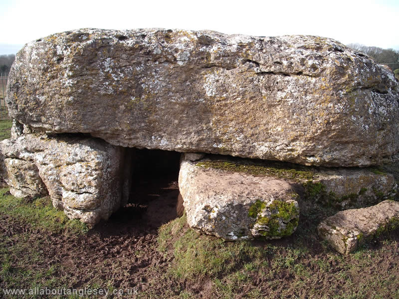
Lligwy Burial Chamber, with an impressively substantial henge capstone, dates back to the late Neolithic period. The capstone measures some 18 feet by 15 feet and has been estimated to weigh 25 tons. It is supported on eight stones. Excavated in 1909, the remains of up to 30 humans were found, along with flints and remains of pots.
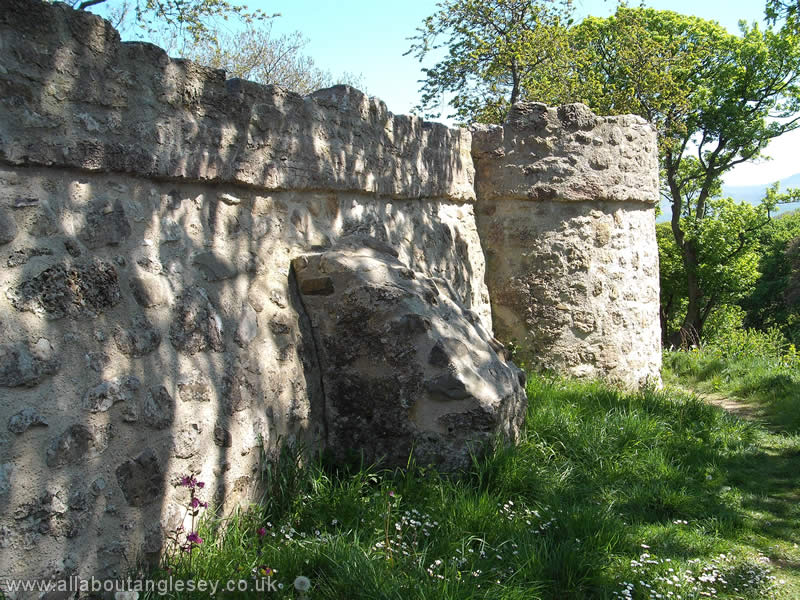
Hen Gapel, Lligwy
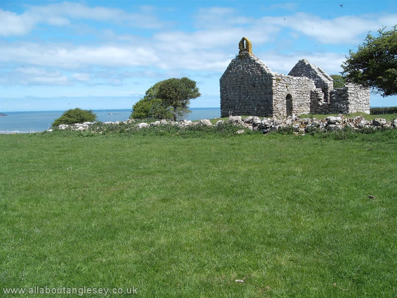
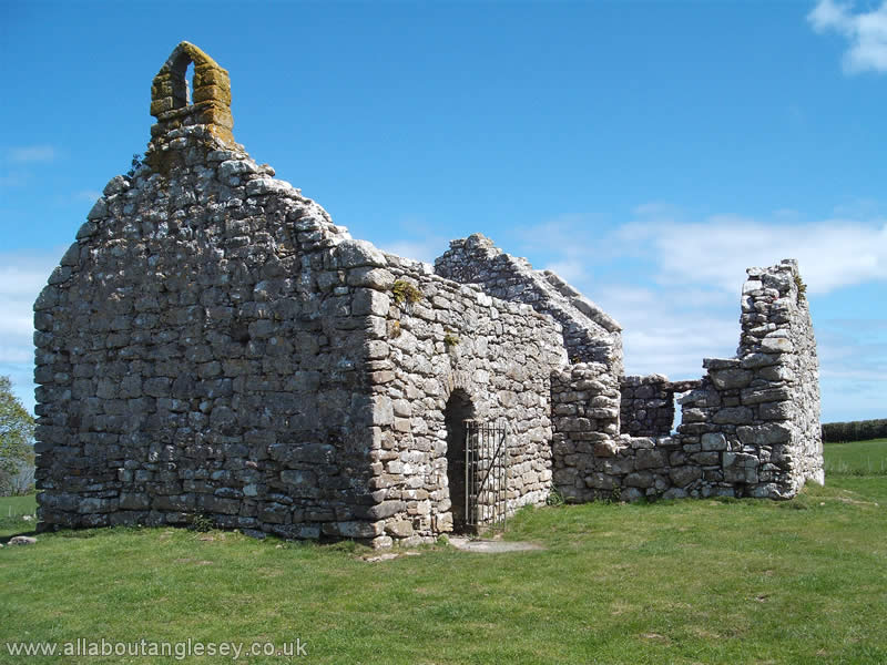
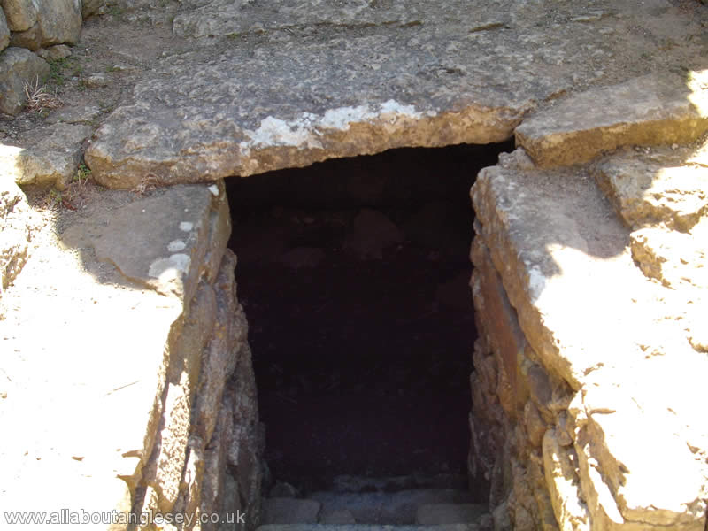
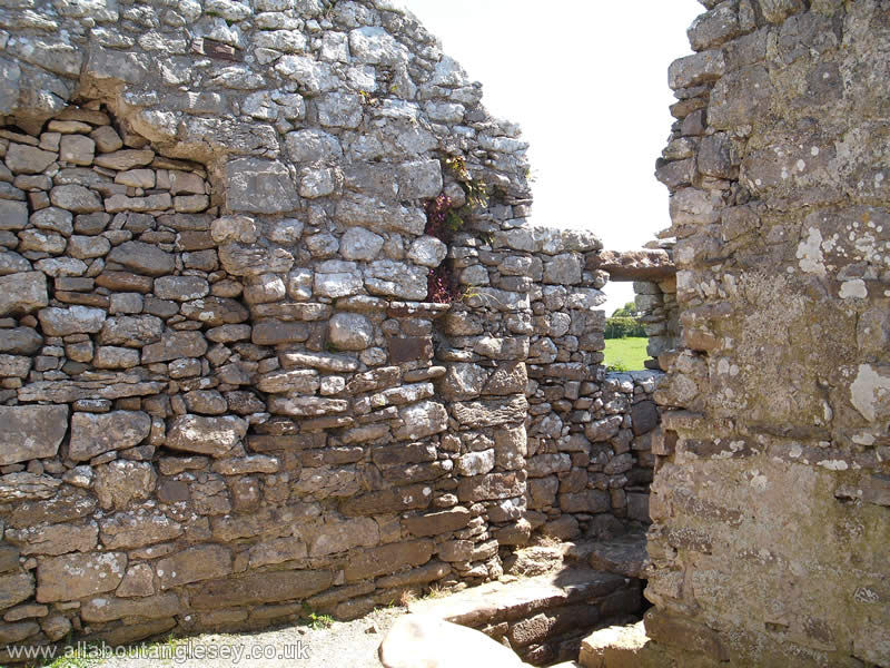
Hen Gapel, Lliwgy (Gapel is a Welsh language mutation from Capel, but means exactly the same) is a modest structure, parts of which date back to the twelfth century. Now missing its roof, the remaining structure of the chapel is well-preserved and includes a bellcote, and a small vault. The crypt or vault, the entrance to which is shown in picture 3 is a later sixteenth century addition, along with the side chapel constructed above it. What is striking about it is that there are no centres of population near to it. The structure has been described as a 'chapel of ease', meaning that it was a subsidiary to a larger church, but that larger church remains unidentified, and the history of this chapel is by no means clear.
Parys Mountain, or Mynydd Parys
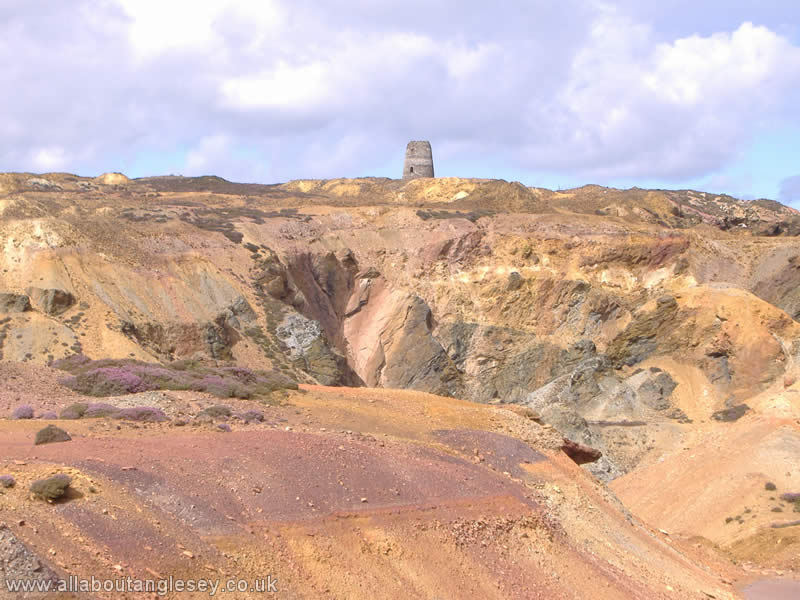
The history of copper mining on Parys Mountain is now known to date back at least to the Bronze Age. At its peak, around the 1770's, the mines became the world's greatest in terms of the amount of copper extracted. The mineral was taken to Amlwch Port for export around world. The copper was also used in the shipping industry, to sheath the wooden timbers of sailing vessels. This practice prevented attack by shipworm, and gave rise to the expression of copper-bottomed guarantees. Copper cladding also gave sailing vessels a speed advantage, and it was used in war ships, including Nelson's flagship, Victory.
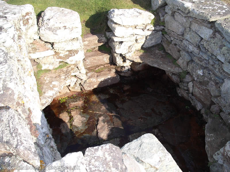
Penmon
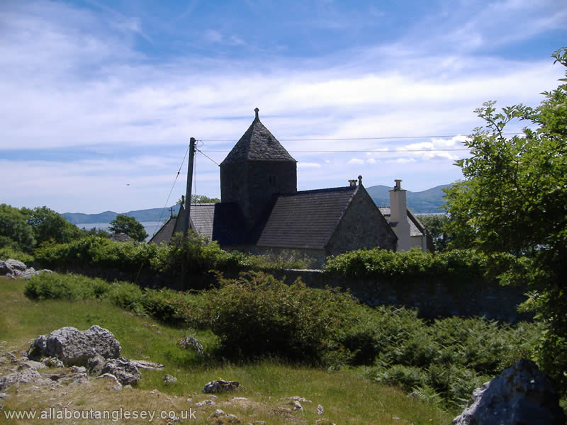
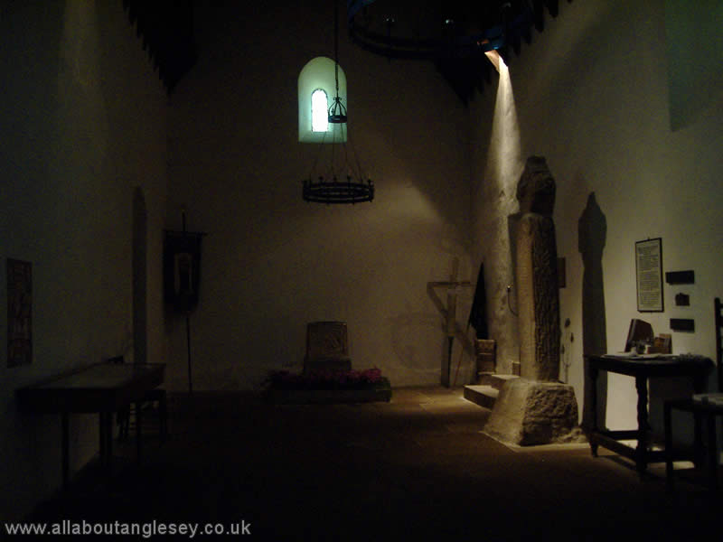
Outside the village of Penmon lies Penmon Priory. The original Priory dates back to the sixth century, but the present structures are from the twelfth century. The sixteenth century prior's house is now in private ownership, and this links the Priory to the Church of Saint Seiriol, which is still in regular use. The church houses a 1,000 year old font, and two crosses, one dating from the tenth century. These crosses were originally outside but were moved into the church for protection from the elements.
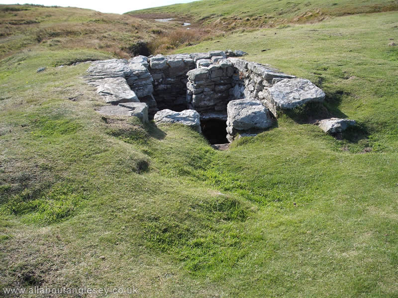
From the church, a path leads to the fish pond, which was in use by the monks as part of their food supply, and ends at St Seiriol's Well. The foundations of this date back to the sixth century, but the brick shelter is a Victorian addition.
Across the road from the Priory is Penmon Dovecote which could house up to 1,000 pigeons. The Dovecote ensured a supply of meat and eggs to the nearby Bulkley Estates.
St Gwenfaen's Well, Rhoscolyn
Gwenfaen was a sixth century saint. The well is close to the abandoned coastguard lookout on Rhoscolyn Head, and its water was said to be noted for its ability to curing mental disorders. The parish church in the village of Rhoscolyn is dedicated to St Gwenfaen.
Ty Mawr Hut Group, Holyhead Mountain
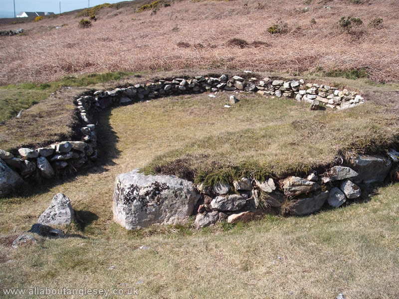
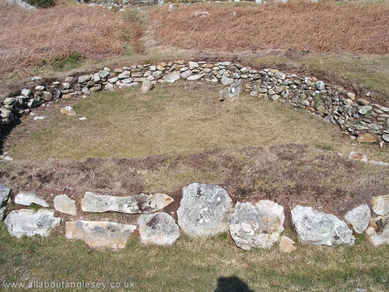
This is located on the road to South Stack. It comprises a number of low circular stone walls, which are the remains of up to ten houses or small farmsteads dating back at least 2,500 years. The site was originally far more expansive, as over fifty buildings were recorded here in the 1860's, spread over an area of some 15-20 acres (6-8 hectares).
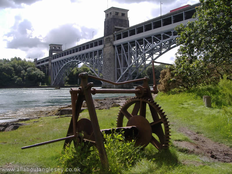
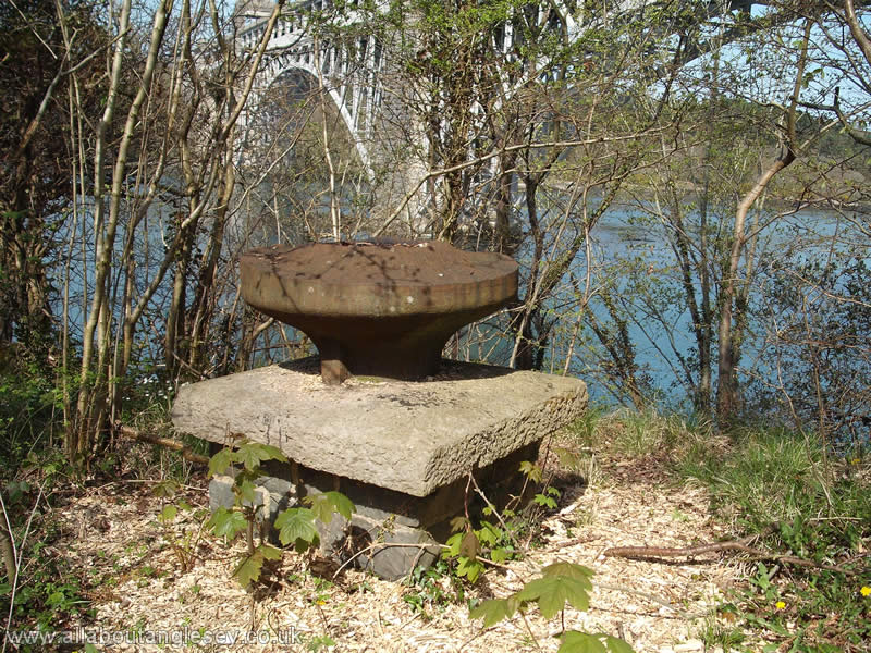
The Britannia Bridge
"If your bridge succeeds, then mine have all been magnificent failures."
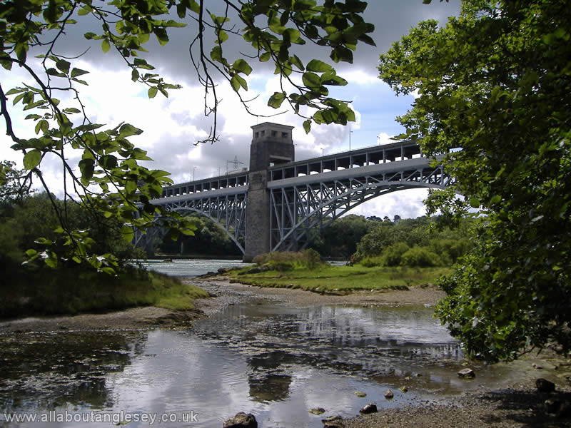
These were the words of Isambard Kingdom Brunel when he learnt of Robert Stephenson's plans to construct a tubular bridge across the Menai Straits. In part, Brunel's words reflected the fact that Thomas Telford had chosen the easiest point at which to cross the Straits when he built his Menai Suspension Bridge, which meant Stephenson was faced with span of 1,475 feet (461 metres), compared with Telford's more modest span of 1,007 feet (305 metres). But Brunel was also anxious about the innovative engineering that the project would entail, as Stephenson had opted for a tubular design. This meant the trains would run through the middle of the wrought iron tubes, rather than on top as would have been expected. In addition, Stephenson also had to meet the same Admiralty demands that faced Telford, that of a clear span of 100 feet (31 metres) above sea level.
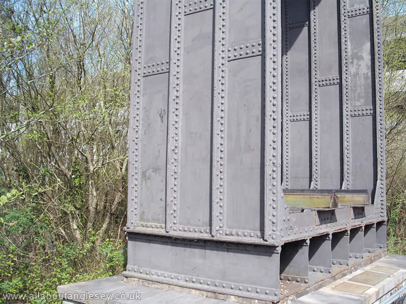
The tubular bridge in fact comprised 8 separate tubes, 4 for the up-line, and 4 for the down-line, positioned between the land abutments, and the 3 new towers. The tubes were constructed in purpose built works on the banks of the Menai Straits, and the 4 largest ones were floated out on pontoons on a high tide. These pontoons were controlled by cables wound round mooring bollards located on the shore, and one of these is shown in the photograph above. The pontoons were then positioned between the new towers, and as the tide fell, the tubes came to rest on temporary supports at the foot of the towers. They were then raised carefully on hydraulic jacks, with masonry being laid beneath them as they were raised. The process took several months, with the Up-line being completed on 5 March 1850. The Down-line was completed and the bridge formally opened to two way traffic in October 1850.
The bridge was an engineering triumph, with concerns over thermal expansion dealt with by the provision of summer and winter rails at the bridge portals. The rails ran within the tubes on longitudinal timbers, and the bridge was covered internally with a canopy of tarred canvas. That arrangement was a long-standing success until outside intervention caused the loss of the bridge in 1970.
The Fire
On 23 May 1970, some children out on a hunt for birds' nests entered the tubular bridge, and lit paper to see their way in the dark. In doing so, they accidentally set fire to the canopy of tarred canvas. A major blaze then ensued, with the timber decking within the tubes providing plenty of combustible material. Although fire services were soon on the scene, there were difficulties in gaining access, and further difficulties in getting a sufficient supply of water. When the fire was eventually put out, the damage was such that the tubes were sagging between the towers, and structural integrity had been shattered.
The future for the bridge was settled within a matter of days, and there was no doubt that the bridge would have to be rebuilt. Apart from the fact that the bridge was a vital link in rail traffic between England and Ireland, a considerable amount of freight was now passing through Holyhead. Passenger numbers had also been increasing.
The reconstruction presented an opportunity to add a road deck and address the issue of increasing road in addition to rail traffic. The towers of the Britannia bridge had survived the fire and could be reused, but no part of the original tubular structure could be retained. The engineers opted to have a new deck for the rail traffic at the same level as the original, but with a new road deck carried on top. The whole structure would be supported on steel arches.
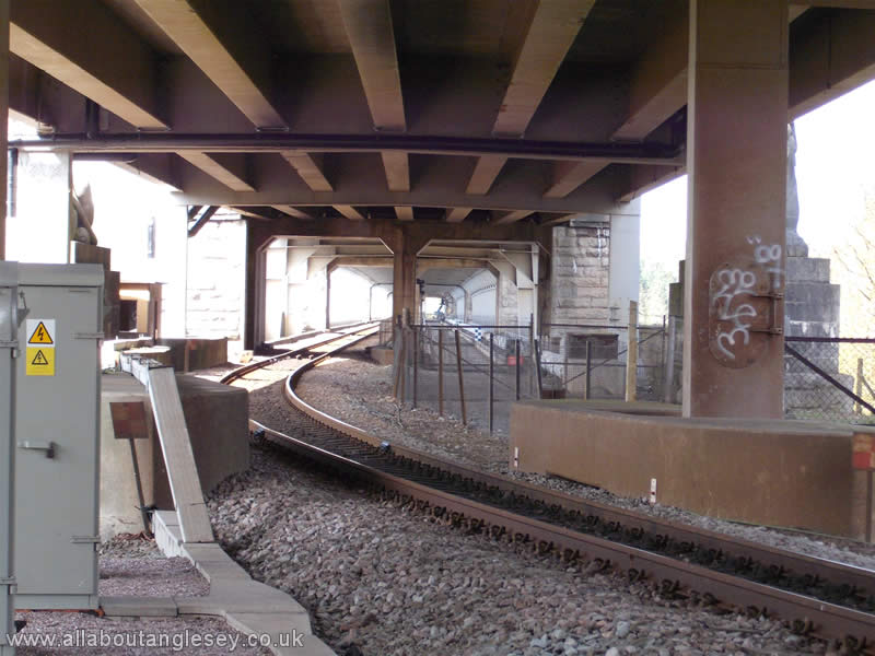
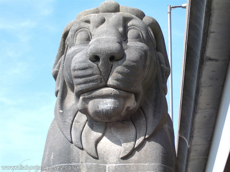
The rail structure was completed in January 1972. Although the deck contains sufficient width to accommodate two running lines, the decision was taken to have a single track, with two line working on either side of the bridge. The road deck was opened in 1980, more than 10 years after the fire. One consequence of the rebuilding is that the four Egyptian style lions, two on each side of the Menai Straits, are now hidden from view, unless you go down to rail level. These lions were the subject of a rather modest poem at the time of the bridge's opening in 1850.
Four fat lions,
Without any hair,
Two over this side,
And two over there.
Pedwar llew tew,
Heb ddim blew,
Dau'r ochor yma ,
A dau'r ochor drew.
However, notwithstanding the addition of a road deck, road demands have continued to increase, and engineers are again looking at how this may be addressed. Alternatives include a tunnel, a new bridge, and additional lanes fixed to the side of the existing bridge.